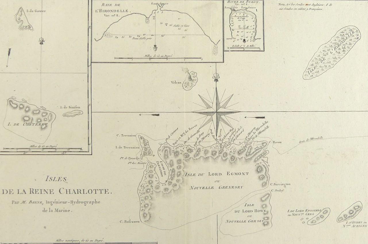
ISLES DE LA REINE CHARLOTTE, 1788
LOT DETAILS
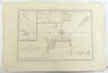
A rare original detailed copper-plate engraving by Jean Andre (Plate 135) from the work of M. Bonne, Ingenieur Hydrographe de la Marine, based on the accounts of Capt. Philip Carteret’s voyage in HMS Swallow accompanied by HMS Dolphin, from the 1774 French edition of James Hawksworth’s official 1772 accounts of the journals of Cook’s voyages, and published in Paris in the French 1788 edition of Rigobert Bonne’s "Atlas Encyclopedique" including 3 inset maps, the largest showing the islands of Gower, Carteret and Simson, the Baye de L’Hirondelle (Swallow) showing anchorage, and Havre de Byron with the interesting notation differentiating the sources of pure and salt waters
The chart shows the 1767 track of Carteret’s ship HMS Swallow (L’Hirondelle) across the northern coastline of Lord Egmont Island; it is interesting to acknowledge the reason for Carteret’s renaming of many of the islands; Carteret had been troubled by a long-standing dearth of patronage, so it was not surprising to see his efforts to flatter Lords Egmont, Edgcomb, and so forth by naming islands after them; Simpson was the Swallow’s Ship’s Master, and Gower, Lt. Erasmus, the only officer healthy enough to actually navigate during most of the voyage following widespread scurvy among the crew
Presented in very good condition, as a folding map, protected in clear film sleeve - image size 22.9 x 34.3cm (9 x 13 1/2in)
