LA NOUVELLE ZEELANDE, 1788
LOT DETAILS
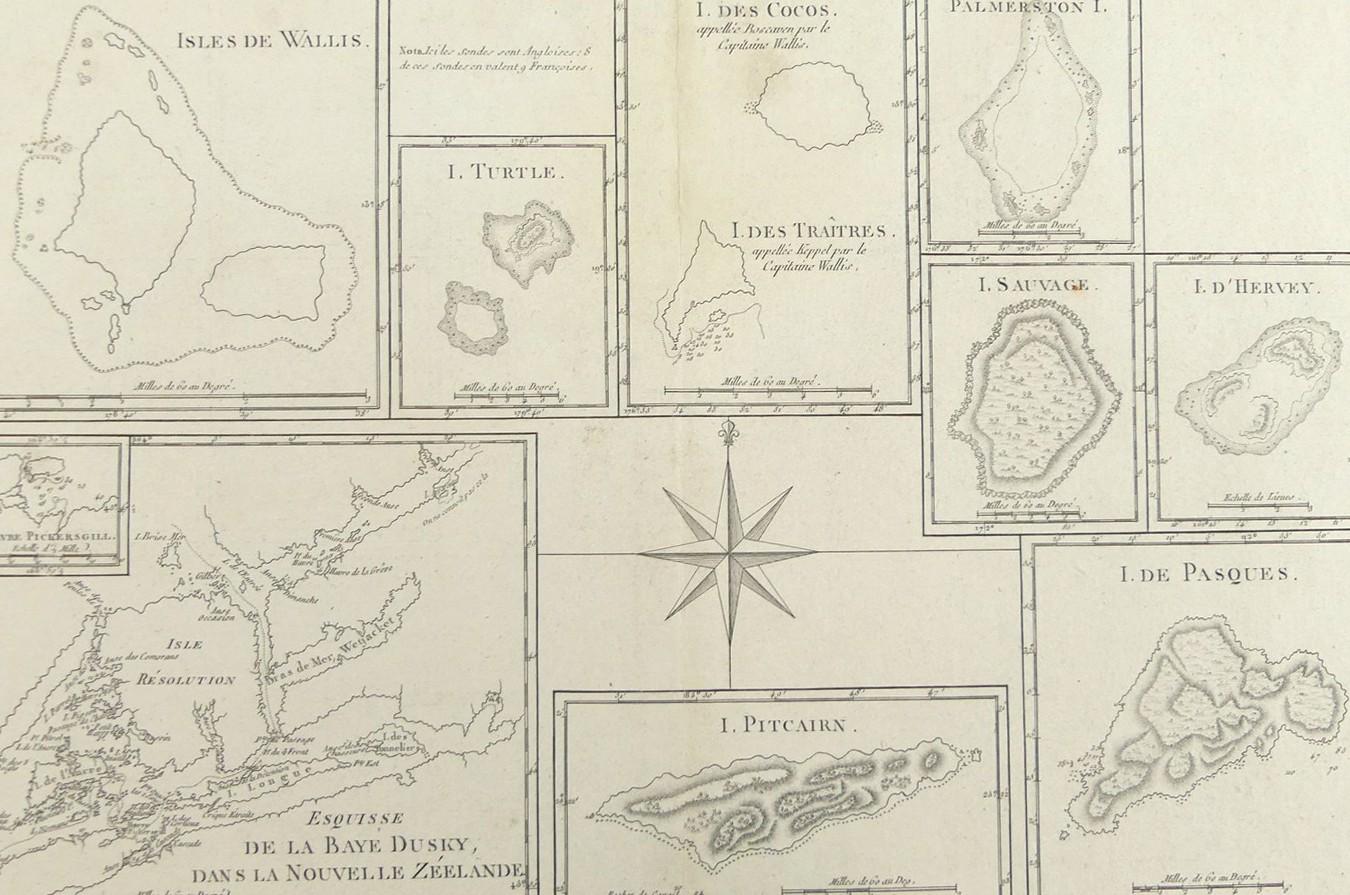
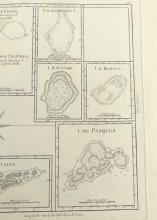
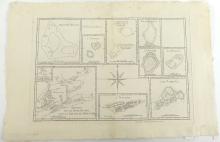
A rare original interesting and detailed copper-plate engraving by Jean Andre (Plate 132) from the work of M. Bonne, Ingenieur Hydrographe de la Marine, based on the accounts of Capt. Philip Carteret’s voyage (1766-69) in HMS Swallow accompanied by HMS Dolphin commanded by Capt. Samuel Wallis, from the 1774 French edition of James Hawksworth’s official 1772/3 accounts of the journals of Cook’s and other explorers’ voyages, and published in Paris in the French 1788 edition of Rigobert Bonne’s "Atlas Encyclopedique" comprising 10 small individual maps surrounding a central compass rose pointing North
The largest inset is a sketch of Dusky Bay in New Zealand with a sub-inset showing an enlarged view of Pickersgill Harbour, Wallis Islands, Turtle Island, Cocos Island and Traitor’s island,Palmerston Island, I. Sauvage, I. D’Hervey, I. de Pasques, and Pitcairn Island; many of these islands were originally discovered by Jacques Le Maire and Willem Corneliszoon Schouten in 1616 during the voyage of 1615-1617 in the Eendracht and Hoorn which departed Holland on June 4, 1615 and rounded Cape Horn on 31 January 1616; presented in very good condition, as a folding map, protected in clear film sleeve - image size 22.9 x 34.3cm (9 x 13 1/2in)