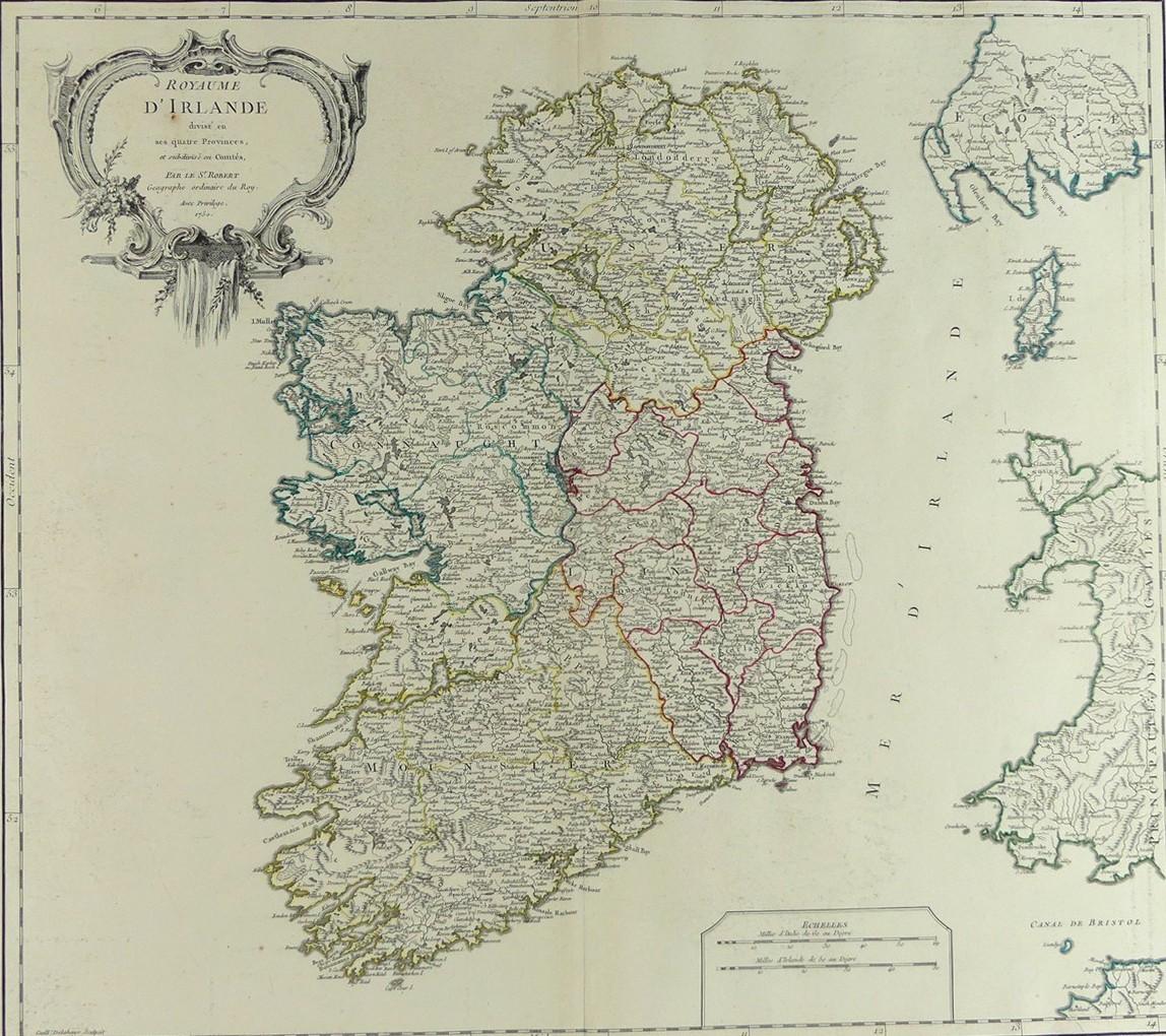
2647
ROYAUME D'IRLANDE, 1750
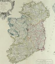
LOT DETAILS
This rare hand-coloured original copper-plate engraving by Guillaume Delahaye (1724-1803) showing Ireland divided into 4 Provinces was created by Robert de Vaugondy, Cartographer to King Louis XV of France, in exceptional detail of local geography and topography; it was likely included in De Vaugondy’s historically important Atlas Universel of 1757; presented in excellent condition on studio board with protective clear film - image size 25.4 x 54.6cm (10 x 21 1/2in)