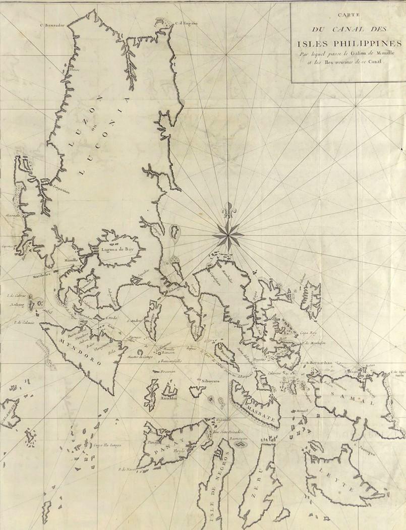
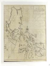
CARTE DU CANAL DES ISLES PHILLIPPINES, 1750

LOT DETAILS
This rare original copper-plate engraving of the Northern Philippine Islands is considered one, if not the most important, of the maps relating to Anson’s circumnavigation of the world and was included in the 1750 French edition of the 1744 Voyage Round the World of Baron George Anson, (1697-1762)
The map (Ref; Tom. II, pg. 334) illustrates the track taken by the Spanish treasure galleons from Manila weaving through neighbouring islands in this narrow Philippine waterway on their way to the open sea and the Americas and the return course; the route was revealed in maps from the attack and capture by Anson aboard his 60-gun flagship HMS Centurion of the Spanish galleon Nuestra Senora de Covadonga, commanded by Don Geronimo Montero, on 20 June 1743, taken off of Cape Espiritu Santo, headland in Tierra del Fuego, at the eastern entrance to the Strait of Magellan; this achievement was the beginning of Anson’s rise to First Lord of the Admiralty and his immense wealth having been awarded the equivalent today of around $18 million!
The mapping of the Spanish treasure ship routes allowed Britain to disrupt Spain’s trade in the Pacific and handicap and reverse Spain’s dominance of the New World for the previous 200 years; the events and activities of Anson’s voyage were documented by the ship’s chaplain, Richard Walter
Presented in fair condition, on studio board with protective clear film, exhibiting evidence of earlier restoration of some peripheral tears with incomplete plate impression, and the multiple folds characteristic of maps bound and published in smaller volumes; although the restoration is less than ideal, nonetheless it does not significantly impact the engraved critical imagery nor detract from the importance of this map - image size 54.6 x 41.3cm (21 1/2 x 16 1/4in)