2656
1790-1792 MAP OF FRANCE


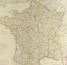
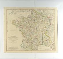
LOT DETAILS
This important hand-coloured original copper-plate engraving shows France divided into Metropolitan Circles, Departments and Districts as decreed by the National Assembly on January 15, 1790; the National Assembly was a revolutionary organization established following the start of the French Revolution on May 5, 1789; this map was published by W. Faden, London, on October 1, 1792; presented in fine undamaged condition on studio board with protective clear film - image size 50.8 x 59.7cm (20 x 23 1/2in)