2070
17TH CENTURY SEA CHART

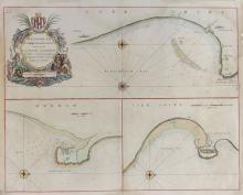
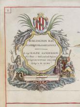

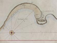
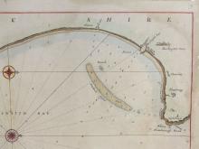
LOT DETAILS
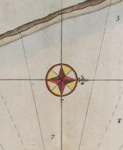
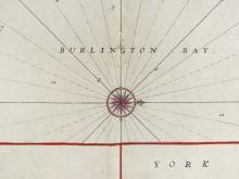
Published circa 1750, an original copper engraved antique sea chart on hand laid paper of Burlington Bay (now Bridlington, Scarborough and Hartlepool), from Greenville Collins' "Great Britain's Coasting Pilot"; elaborate title cartouche includes a dedication from Collins to Captain Ralph Sanderson, and with attractive hand-colouring throughout; fine condition for age other than some light discolouring, few losses around edges and central folding - unframed, the sheet size measures 47.6 x 59.1cm (18 3/4 x 23 1/4in); Special Note: the N.B. compass rose has North pointing right and there is a cross on the rose to depict the direction of Jerusalem