THREE PACIFIC ANTIQUE MAPS

LOT DETAILS
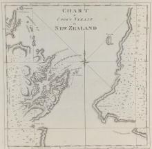
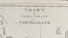
Chart of Cook Strait in New Zealand (1773), rare First Edition copper plate engraving by John Ryland from John Hawkesworth's "Account of the Voyages undertaken by Order of his Present Majesty for Making Discoveries in the Southern Hemisphere" printed for W. Strahan and T.Cadell 1773; this is acknowledged as the first and most superior issue of this chart and can be identified by the position of the title within the map area, whereas later issues by other publishers (e.g. Alexander Hogg in 1785) placed the title outside the map area; in very good condition, with lower plate impression boundary below the image missing and bottom right small section beyond plate impression missing, likely in removing the map from its original volume binding), showing fold as published, protected in clear film sleeve, image size 26.7 x 27.3 cm (10 1/2 x 10 3/4in)
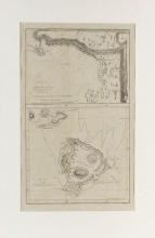
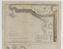
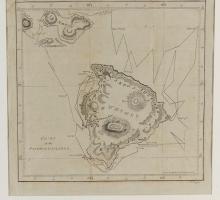
Sketch of Karakakoa Bay (Owhyhee) and chart of the Sandwich Islands 1796, both maps from Cook’s Third Voyage, comprising one large copper plate engraving by William Rollinson (1762-1842) English-born American engraver from 1790 in New York, and published at Philadelphia in 1796 by Matthew Carey in his American Edition Atlas of Cook and other exploration discoveries; in good condition with complete plate impression and showing professional repair to first map with cream mat and protected in plastic sleeve, image size 31.1 x 18.8 cm (12 1/4 x 7 3/8in)