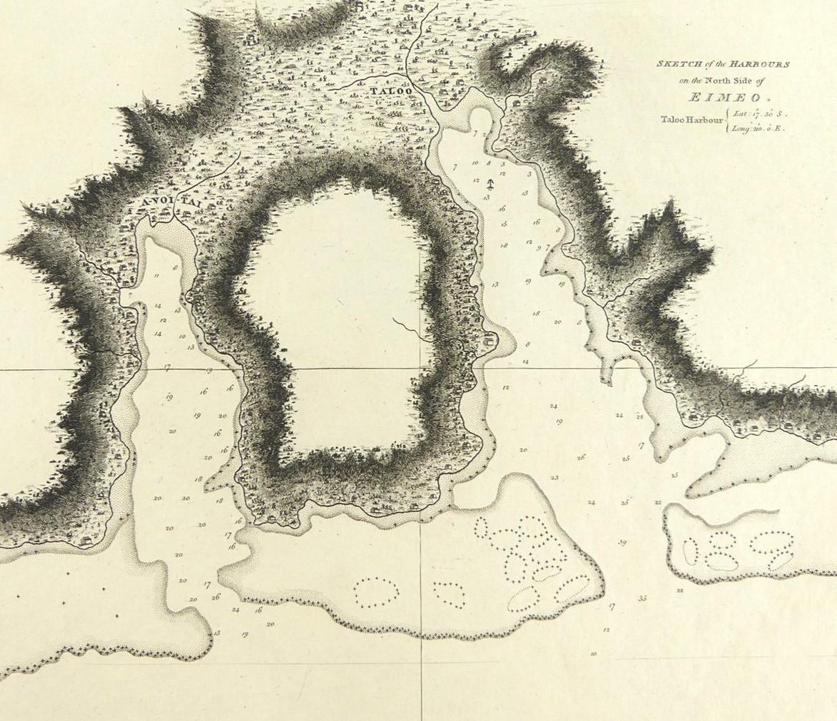
2703
SKETCH OF THE HARBOURS ON THE NORTH SIDE OF EIMEO, 1784

LOT DETAILS
A rare original detailed topographical copper-plate engraving (Plate 50) from William Bligh in December 1777 on Cook’s Third Voyage, and published in 1784 by Order of the Lords Commissioners of the Admiralty, printed by W. & A. Strahan for G. Nicol and T. Cadell
The map shows the anchorage location and local habitations; Eimeo or Moorea is a volcanic island about 17km northwest of Tahiti; presented in very good condition, protected in clear film sleeve - image size 18.4 x 21cm (7 1/4 x 8 1/4in)