4066
MAP OF THE AMERICAS CIRCA 1683


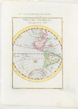
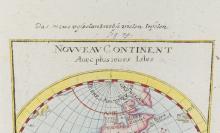
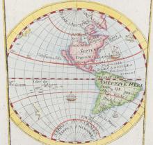
LOT DETAILS
Small map of the Americas as known in the late 17th century by A. Mallet, French cartographer, depicting explored territory of North and South America, the Caribbean, Azores, and showing California as an island; sailing ships depicted in both the Atlantic and Pacific oceans; sheet size 20.3 x 15.9cm (8 x 6 1/4in), unframed