4002
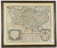
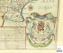
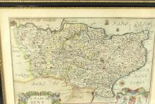
17TH CENTURY MAP OF KENT COUNTY, ENGLAND


LOT DETAILS
"A Map of Kent with its Laths and Hundreds" by Richard Blome by His Majesty's Command, hand-coloured copper engraved map of Kent with the title cartouche of flowers and fruit; it shows all the lathes and hundreds but no roads, with a scale of ten miles, centre fold mark - image size 26 x 32.4cm (10 1/4 x 12 3/4in), housed in a nice antique frame