3317
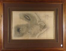
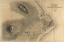
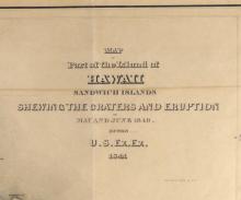
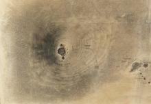
19TH CENTURY MAP OF HAWAII

LOT DETAILS
"Map of Part of the Island of Hawaii, Sandwich Islands Shewing Craters and Eruption of May and June, 1840"; finely crafted and beautifully coloured steel plate engraving, from the 1841 United States Exploring Expedition into the Pacific led by Commander Charles Wilkes, USN, published 1845; presented in fine condition in custom Koa wood frame, image size 40.6 x 59.7cm (16 x 23 1/2in); frame outer dimensions 76.2 x 96.5cm (30 x 38in)