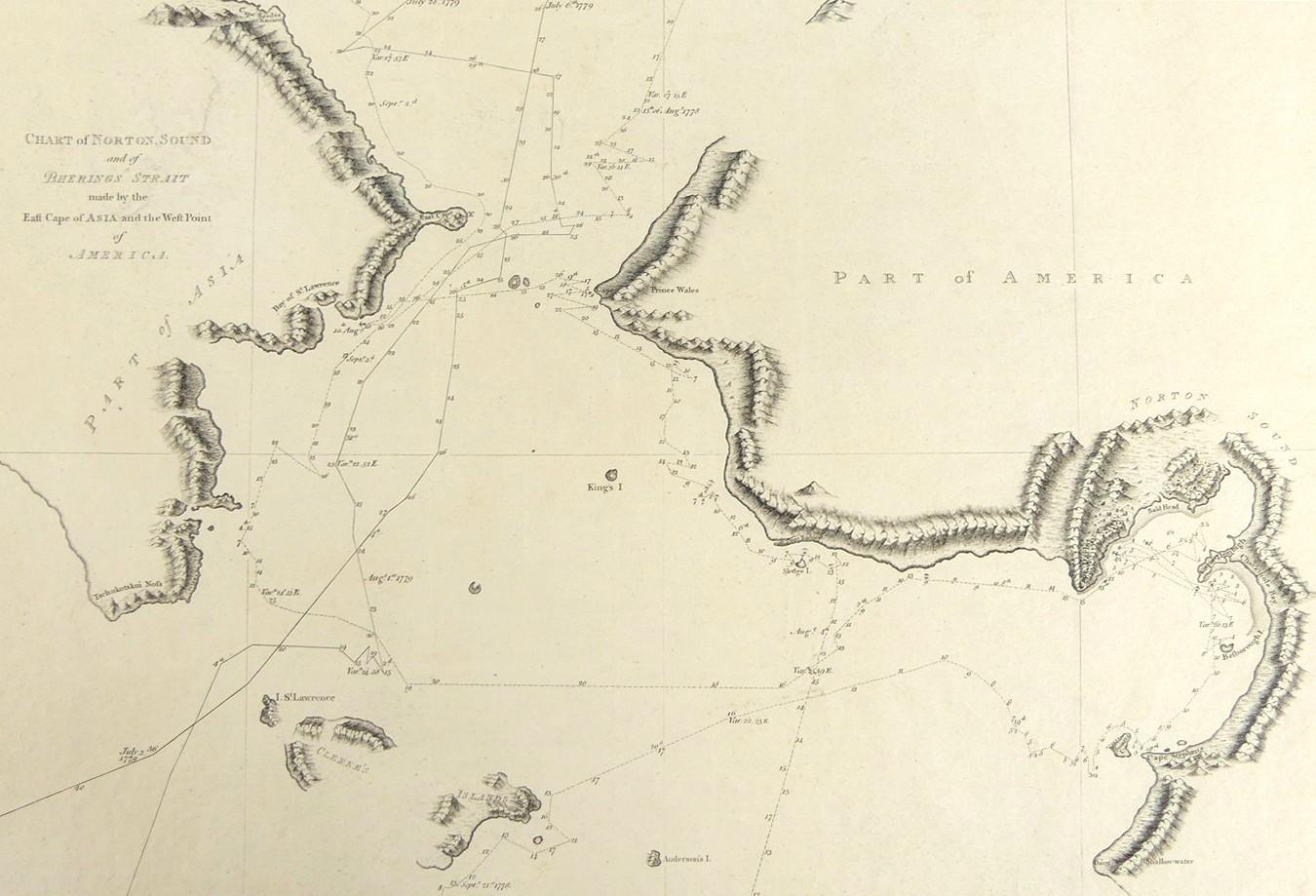
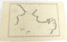
CHART OF NORTON SOUND AND OF BHERINGS STRAIT, 1784
LOT DETAILS
A rare original copper-plate topographically detailed engraving (Plate 53) from Cook’s Third Voyage, and published in 1784 by Order of the Lords Commissioners of the Admiralty, printed by W. & A. Strahan for G. Nicol and T. Cadell; the chart is unique in the inventory of the Cook voyages portfolio and very interesting in that it shows that the expedition made two visits to the area, the first led by Cook himself, and the second by HMS Resolution under the command of Capt. Charles Clerke, following the death of Cook in Hawaii
The first visit shows Cook entering the area on August 4th, 1778, making their way along the coast with several anchorage points along the tracks, crossing the Bering Strait on August 9th when they sighted the coast of Asia, anchoring off the Bay of St Lawrence on the 10th; from there they sailed North until they encountered the first ice on August 13th before crossing the Arctic Circle on the 14th; Cook continued on north until he encountered the Arctic ice sheet and, despite several attempts, could find no way past it and decided on the 18th to return south, again approaching the coast of Asia on September 2nd until turning East to reach Norton Sound on the 8th.where they spent 10 days before departing Cape Stephens on the 18th sailing West towards Clerke’s Islands where on September 21st 1778, Cook turned south out of the area
The second visit shows the expedition entering the area on 3rd July 1779, crossing the Bering Strait on the 5th, but Capt. Clerke was also forced to turn back south by the Arctic ice, re-crossing the Bering Strait on July 30th, and departing the area on August 4th as he passed the island of St Lawrence, heading for the Kamchatka Peninsula and onward to Japan; presented in very good condition, protected in clear film sleeve - image size 26.7 x 38.7cm (10 1/2 x 15 1/4in)
