2630
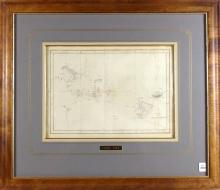
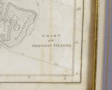
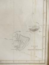
1784 CHART OF THE FRIENDLY ISLANDS


LOT DETAILS
Original charts from Cook’s Third Voyage of Discovery (1776-1779) are distinguished by both their high degree of accuaracy and their historic importance; Captain James Cook singlehandedly mapped the Pacific Ocean and was the first explorer to visit and chart the islands of Hawaii, New Zealand, Tonga, Tahiti, The Cook Islands, and the east coast of Australia; this chart is from the first textual edition of "COOK’S THIRD VOYAGE", published by Strahan and Cadell of London in 1784; image size 25.4 x 31.8cm (10 x 12 1/2in); a fine example presented in Koa wood frame with engraved brass plate, frame outside dimensions 55.9 x 64.8cm (22 x 25 1/2in)
