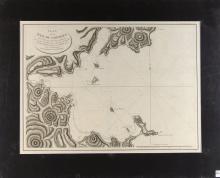
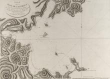
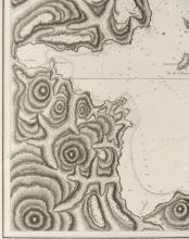
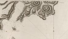
2073
PLAN DE LA BAIE DE CASTRIES MAP


LOT DETAILS
Original copperplate engraving of visitations in July, 1787and published in 1797-1798 in Atlas du Voyage de la Perouse; presented in fine condition and is an important and impressive finely detailed charting of the Bay; image size 49.5 x 68.6cm (19 1/2 x 27in); Certificate of Authenticity verso from Lahaina Printsellers Ltd., Maui, Hawaii