2048
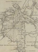
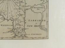
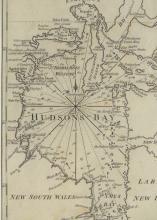
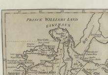
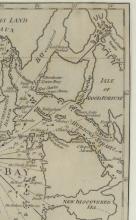
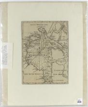
MAP OF HUDSON'S BAY CIRCA 1745-1750


LOT DETAILS
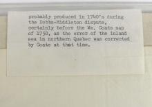
Very early original map of Hudson's Bay and area with Prince Williams Land to the north and New South Wales and Labrador or New Britain to the south; cartographer unknown, but considered opinion states the map was "probably produced in the 1740's during the Dobbs-Middleton dispute of 1743-1745, certainly before the Wm. Coats map of 1750, as the error of the inland sea in northern Quebec was corrected by Coats at that time"; the map is in very good condition for its age, image size approximately 15.2 x 20.3cm (6 x 8in); exhibiting no damage and protected by plastic sleeve